Your cart
There are no more items in your cart
Logo menu mobile
- Sport fishing
- Artificial baits
- Artificial baits for octopus
- Artificial baits for sea bass
- Artificial baits for trout
- Artificial lures for trolling
- Artificial spinning lures
- Black bass lures
- Deep sea squid
- Eging baits
- Greenhouse baits
- Hard Baits
- Hybrid and Spinner Baits
- Inchiku artificial baits
- Jigging lures
- Lures for perch
- Pike baits
- Silicone artificial baits
- Spare parts for artificial baits
- Squid lures
- Tuna spinning lures
- Equipment and crew
- Accessories and spare parts for feeders and mincers
- Belly Boat
- Boat feeder
- Boga grip
- Bring Egi
- Combat belts and kidneys
- Fish knife
- Fishing bag
- Fishing boxes
- Fishing boxes
- Fishing bucket
- Fishing cart
- Fishing case
- Fishing disgorger
- Fishing gaff
- Fishing landing net
- Fishing line holder
- Fishing pliers
- Fishing scale
- Fishing scissors
- Fishing terminal holder
- Gibernetta
- Longline basket
- Sardine chopper
- Fishing baits and additives
- Fishing line
- Fishing reels
- Fishing rods
- Fishing tackle and accessories
- Assist hook
- Deep sea fishing lamps
- Fishing hooks
- Fishing hooks
- Fishing leads
- Fishing meter counter
- Fishing reel
- Fishing snap hook
- Fishing swivels
- Fishing Tackle
- Fishing Teaser
- Hydrodynamic sinker
- Jig head
- Offset hooks
- Skirted Jig
- Spare parts for deep sea squid jigs
- Split ring
- Stoppers, beads, sleeves and sheaths
- Trolling release clamp
- Artificial baits
- Nautical accessories
- Clothing and accessories
- Water sports
- Brands
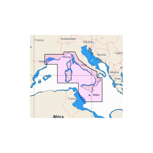
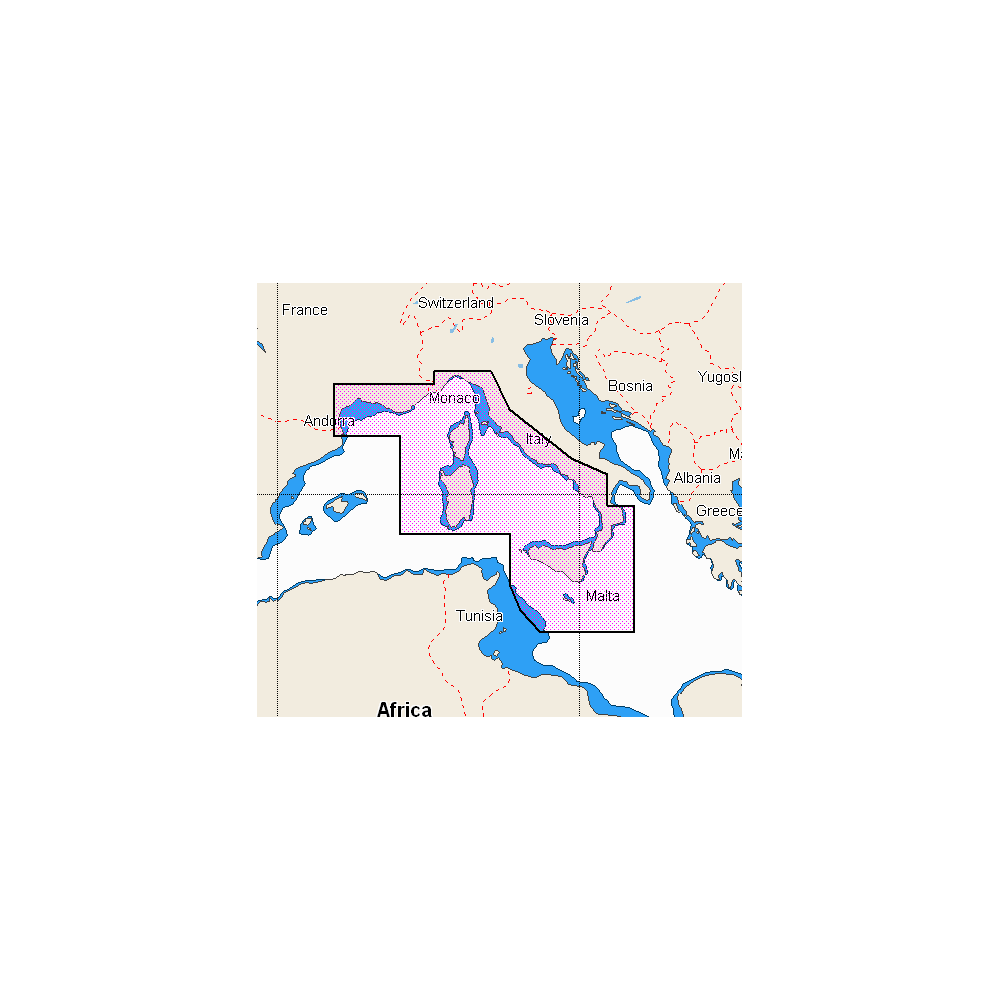
C-MAP Discover/Reveal cartography with SD/Micro SD support

Cartography for Lowrance, B&G, and Simrad. Vector charts, including depths, contours, spot soundings, NavAids, light sectors, wrecks/obstacles, and more.
Alternative products
Description
View the highest level of information, setting clear safety depths and identifying underwater pinnacles, ledges, and canyons—magnets for coastal game. High-resolution detail of nearshore and offshore features like pinnacles, canyons, and ledges helps anglers, including Genesis data. EASY ROUTING WITHOUT A SUBSCRIPTION. View time, water level, and tide direction with tide level graphs and indicate the current time, direction, and predicted strength. Flow graphs and colored arrows. Ensure your instrument software is the latest version available. 32GB SD/MSD SUPPORT
Tap to zoom