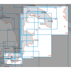
Electronic Cartography

Nautical Cartography for Boats | Electronic Boat Instrumentation
Nautical cartography is the set of technical, scientific and artistic knowledge aimed at representing in a symbolic but truthful way geographical information related to navigation, on flat supports such as nautical charts or spherical as the globe. There are no nautical charts dating back to before 1200, but according to the latest research the sailors who lived before this period created the maps during the journey and then threw them away, while other theories...

Nautical cartography is the set of technical, scientific and artistic knowledge aimed at representing in a symbolic but truthful way geographical information related to navigation, on flat supports such as nautical charts or spherical as the globe.

There are no nautical charts dating back to before 1200, but according to the latest research the sailors who lived before this period created the maps during the journey and then threw them away, while other theories argue that they were lost in the various shipwrecks and during the following periods.

In Italy, the first nautical chart dates back to the thirteenth century, a document found in Pisa and for this reason called "Carta Pisana", a nautical chart drawn with great precision.

But the era of the Maritime Republics was the most flourishing period for these charts, in fact about 180 nautical charts have been found that date back to the period between the thirteenth century and the fifteenth century. Most of these charts were made in Italy and belong to the schools of Ancona, Genoa and Venice, cities where charts were made at the nautical schools.

Another flourishing period for nautical charts occurred during the Dutch seventeenth century, when the printing activity experienced a golden age, as well as geography and cartography, in fact there are several testimonies that attest to the commitment of the time to this subject.

In the twentieth century the history of nautical cartography has changed radically and in addition to the Hydrographic Institutes also private publishers began to take an interest in the printing of nautical charts, work that was no longer performed only on paper but also using other materials such as soft plastic, etc..

Since then, nautical charts have been continuously updated, the number of publishing houses that publish them has increased considerably and still today many charts are printed on all kinds of media, although in recent years to take the place of paper charts are electronic systems designed and developed specifically, although they are always based on official cartography.

The first company to produce software designed for this use was Navionics, in 1984 and since then the nautical charts sector has changed progressively as electronic systems have improved more and more the charts of the past and today these modern tools are defined by an electronic chart standard called ECDIS (Electronic Chart Display and Information System).

Types of nautical charts

Based on scale, nautical charts are divided as follows:

- OceanicOceanic: they have a scale superior to 1:3.000.000

- GeneralGeneral: the scale is between 1:3,000,000 and 1:500,000 and are used in offshore navigation, but are not suitable for coastal navigation as they do not contain enough detail.

- Coastalhave a scale between 1:500,000 and 1:50,000 and are very detailed charts, used mainly for coastal navigation.

- Nautical plansnautical plans : they are charts that use gnomonic projection, on a large scale, but at the same time they report many details related to their scale.

On any type of chart are reported latitude and longitude and the division of the first is decimal, are also reported projection, scale and magnetic declination with the year of reference and bathymetric lines. Not only that, are also reported signs compatible with the scale, using a standard symbology.

How to read nautical charts

Especially for short- and medium-range navigation, the most widely used charts are Mercator charts, whose distinctive feature is a projection in which the equator and parallels are represented by horizontal parallel lines, drawn perfectly perpendicular to the meridians.

On the nautical chart, because of the parallelism of the meridians, the length representing the parallel lines between two meridians is always the same, in practice dilated when the latitude increases compared to the true situation of the terrestrial sphere and even if it is possible to make charts in marker representation up to latitudes of eighty degrees, it is preferable to limit the construction up to the latitudes of the polar circles sixty-six degrees approximately.

In essence it is essential to remember that to avoid making mistakes in measurements, the distances of the routes should be calculated in correspondence of the latitude in question, using the nautical compass.

rhumb line and orthodromic course

When they have to choose a route rather than another, navigators generally rely on three criteria: ease, brevity and safety, and this is called rhumb line, a route that can be plotted easily using the marker chart.

On the other hand, the orthodromic route is the shortest line joining two points on the sphere and the arc, which is 180 degrees smaller than the maximum circle passing through them, and the gnomonic chart is the most suitable for plotting this kind of route.

To read a nautical chart you need to know some basic information that you generally learn when you study for your license, but to avoid forgetting what you have learned is good to practice often with cartography.

Nautical charts, wherever they are produced, have certain elements in common and while work is being done to make standard charts so that they can be used anytime and anywhere, the INT charts remain the universally recognised ones.

The various colours that one looks at on a nautical chart serve to highlight features and various classes of information, while the symbols, which are used for details are very important and should be consulted carefully.

For example, in brochure 1111 INT 001 all symbols, both international and non-international, that are used on various nautical charts are shown and their meaning is described: who published the chart, the various sea areas and coastal stretches represented, the reference reliefs, the cartographic projection that was used, the scale of the chart and the reference latitude, the geodetic reference, the units of measurement of elevations and depths with their reference levels, various warnings, possible corrections, etc.

Nautical cartography electronic

The development of technology together with the need to manage navigation data more quickly and efficiently has led to a change, namely the development of electronic navigational charts (ENC).

This is a digital database produced by a Hydrographic Institute or a government agency that is standardized in content, format and structure.
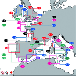
In order for the electronic chart to have a legal value and to be used instead of the paper nautical chart, the ENC must be used through a specific instrument on board called ECDIS (Electornic Chart Display and Information System), a rule provided for by the Convention on Safety at Sea.

In partica, the electronic nautical chart is an interactive version of the traditional nautical chart and can be consulted as a series of layers that obtain various overlapping and viewable information according to one's needs.

Consulted on the ECDIS, the electronic nautical chart is similar to a classic paper chart, but it contains all the information concerning each element and allows the display of the descriptive and spatial characteristics of any kind of represented object, which can be selected with the cursor.

Furthermore, the ENC also allows access to other nautical information such as the Lighthouse List, Radio Services, etc. Not only this, but it can also contain digital images depicting the coastline and other information that is not contained in traditional nautical charts.

The production of the ENC started at the end of the '90s and after a period in which tests were carried out on board Navy ships, the Hydrographic Institute of the Navy started the production for a widespread distribution.

Currently there are more than 250 types of cards published and among the advantages offered by these innovative systems is the simplicity with which you can consult the cards, and the security represented by the updates that occur in a certain way and in a short time.

Nautical GPS: what is it?

The Nautical GPS, also called marine GPS, marine navigator, chartplotter and plotter is an important tool for navigation.

It is a type of technology born in Italy, even before the invention of road navigators, precisely the first plotters for navigation date back to 1984.

Born from the idea of two engineers who later split up and founded Navionics and C-Map respectively, Nautical GPS today are developed by numerous companies, although these two companies are still considered among the best in the industry.

Today's navigational plotter is a true on-board computer, equipped with numerous sensors and additional options, controlled from the same unit, moreover today's nautical GPS have numerous functions that before could only be performed with the help of traditional nautical charts.

In essence, the Nautical GPS increases the ability to obtain information, based on the state of navigation:

When the boat is stationary:

- Monitor your position on the chart;

- Check the distance to a precise point;

- View the position of the nearest boats;

- Check the weather situation, etc.

When the boat is movingdirection and speed.

If GoTo is set:

- useful information about the expected time to reach the set destination;

- calculation of distance and course to the destination point;

- information on any corrections to be made if there is an off course, etc.

Graphic information

Depending on the graphic cartography used, the nautical GPS can provide different information graphics, here are the three most common display modes:

- 2D plan: this information is taken from the official databases and is the best way to display it in terms of safety, since the data provided is official and the plan is presented in the way man has always analysed the sea surface and the map.

- 3D visualization: present in some very precise cartographies, useful in fishing because it offers a perspective on the seabed.

- Satellite visualization: not very suitable for navigation (especially for manoeuvres), but very good to have a clear idea of how the place you want to reach looks morphologically, etc.

As for the symbols, there are 7 the most important ones that can be displayed with this system:

- Line of direction present in front of the bow;

- Mark

- Your position;

- The course, represented by various symbols joined together by a line;

- Bathymetrics;

- Dangerous areas, if any;

- Port services.

In addition, numerous numerical data can be displayed (date, time, Lat/Lon, etc.).

Nautical GPS: current regulations

According to the regulations in force, it is compulsory to have a radio-positioning instrument on board when the boat exceeds 12 miles, so even a simple GPS showing only longitude and latitude could be enough.

Having a nautical GPS on board that contains nautical cartography is not enough, in pleasure boating it is necessary to also have traditional nautical charts that refer to the navigation area.

Basically, a nautical GPS that contains electronic charts does not replace the classic nautical charts on board. These remain the main point of reference and the captain must be able to read them. The only exception is made for vessels subject to GMDSS and equipped with a certified nautical GPS system.

There are many brands that produce nautical GPS and prices vary depending on the various models available, the functions with which they are equipped, etc..

In any case, considering the amount of information that a state-of-the-art nautical GPS can offer, almost all boats are equipped with this kind of electronic system, often even when it is not mandatory.

In order to compare various models, prices and choose the nautical GPS that best suits your needs, it is advisable to purchase it in a specialized shop in the sector, where in addition to finding numerous models you can also have the necessary assistance both during and after sales, assistance that is provided online and offline by competent personnel.

A site where you can compare and buy nautical GPS and other useful equipment for boats is on the site of HiNelsonpurchases are made in complete safety and is guaranteed the originality of products marketed as well as having a valid assistance.

Read more
Filter by
Main brand compatibility
Zone
more... less
Manufacturers
more... less
Support
Filter
Product added to wishlist